GPS coordinates, a map thumbnail, address, altitude and timestamp — burned straight onto your photos and videos. Plus 3D scans and 360° panoramas, all processed on your device.


One camera that records where, when and what — in a form no one can question.
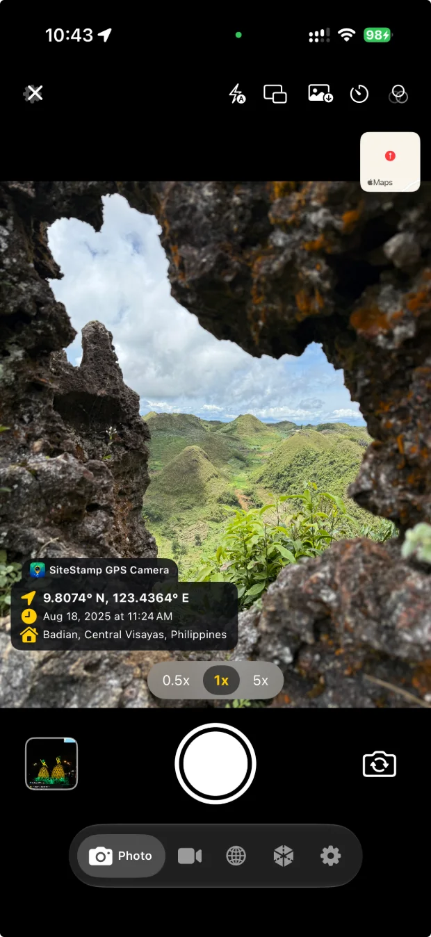
Every capture carries a map snapshot and GPS coordinates in your preferred format — decimal, degrees & minutes, DMS or Plus Codes — plus address, altitude and timestamp.
Record video with the live location overlay burned right in, and export the full GPS track as GPX, CSV or KML. Stabilisation modes and HDR (HLG) capture included.
Scan rooms with LiDAR or objects via photogrammetry. Get floor area and volume metrics, re-walk the result in a 6-DoF viewer, and export USDZ or PLY.
Stitch a full equirectangular panorama from high-resolution tiles, then explore it by drag or gyro. Export a geotagged Tiny Planet straight from any sphere.
Choose exactly what appears: GPS, address, date & time, altitude, pressure, weather, timezone and a custom note. Strip or floating panel — plus your own logo in any corner.
Multi-lens support, dual-camera picture-in-picture, tap to focus, flash modes, shutter timer, 8 white-balance presets and front/back switching.
Photos, videos and 3D scans land in one chronological gallery. Organise into albums, multi-select, share in bulk, or open any location in Maps.
On iPhone and iPad, optionally sync your library through your own private iCloud Drive. On any device, pre-download map tiles so the geotag minimap keeps rendering with no signal.
Capture and compositing happen on-device. No accounts, no third-party tracking — and optional sync stays inside your own iCloud, never our servers.
Select a job's captures and export them as one paginated PDF — site map, capture index and every stamp preserved. A4 or US Letter, one to four captures per page.
See it workSwitch modes in the viewfinder. Everything lands in the same gallery with the same location record.
The location strip is composited into the video itself, so the proof survives re-encoding, sharing and export.

Room scans via LiDAR, object scans via photogrammetry — each one geotagged and timestamped like every other capture.

Capture high-resolution tiles, stitch them into a full equirectangular sphere, then explore it by drag or gyro.

Captures are only half the job. Select the photos, videos and scans from a job and Site Stamp lays them out as a paginated PDF — site map, capture index and every stamp intact.
Photo, video or scan — each one carries GPS, address, altitude, accuracy, weather and a live map thumbnail, composited at the moment of capture.
Open the gallery, multi-select the captures that belong to a job across photos, videos and scans, then tap Report.
Site Stamp builds a paginated document with a site map, a capture index and every stamp preserved. Share it or save it straight from the sheet.
Every shot carries its own evidence — map, coordinates, address and time, composited on-device.


Photos that speak for themselves — no one can question where or when the shot was taken.
The camera, the overlay and the gallery are free forever. Pro unlocks branding, pro capture and sync.
No account required.
Subscription — current price shown in-app.
Feedback from Site Stamp users in the field.
“Very useful especially on field.”
“Very satisfied.”
GPS coordinates, a reverse-geocoded address, a map thumbnail, date and time, altitude, GPS accuracy, barometric pressure, weather, timezone and a custom note. You choose exactly which fields appear, and whether they sit in a strip or a floating panel.
No. Capture and compositing happen entirely on your device, with no account and no third-party tracking. iCloud Drive sync is optional and, when enabled, stays inside your own iCloud — never our servers.
Four: decimal degrees, degrees and decimal minutes, full DMS notation, and Plus Codes for universal location sharing.
Yes. GPS itself needs no data connection, and you can pre-download map tiles so the geotag minimap keeps rendering offline. Addresses are geocoded when a connection returns, and can be edited afterwards.
Yes. Videos save a GPS track alongside the clip, exportable as GPX, CSV or KML. The sampling interval is configurable from every second up to every ten seconds.
Room scanning uses LiDAR, so it needs a LiDAR-equipped device. Object scanning uses photogrammetry and works more widely. Both export USDZ or PLY and report area and volume metrics.
Yes, with Pro. Upload a logo in overlay settings and place it in any corner, alongside an optional app-name badge and custom note.
iPhone, iPad and Android. iCloud Drive sync is an Apple-platform feature; Android captures save into DCIM/VerifEye on the device.
Free to download. No account required.
10.3186°N · 123.9057°E · SITE STAMP
